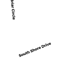
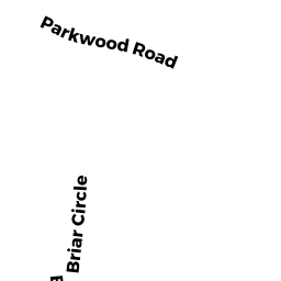
27 BRIAR CIR
Owner Information
COONEY PETER
27 BRIAR CIRCLE
SOUTH YARMOUTH, MA 02664


Property Details
27 BRIAR CIR is classified as a Multiple Houses on one parcel (Conventional).
The primary structure on this property was built in 1940. There are 4,271ft2 of built area within this property. There is 2,583ft2 of residential/living space within this property.
27 BRIAR CIR is valued at $794,500. The land is valued at $297,400 and the structures are valued at $488,500. There is an additional valuation of $8,600 on this property.
The most recent deed for 27 BRIAR CIR is recorded at the local registrar in Book 12698, Page 51. 27 BRIAR CIR was last sold on Wednesday, December 1, 1999 for $240,000.
Assessment data from fiscal year 2022.
Flood Data
This property is completely within the AE Zone (within floodplain).
The base flood elevation for this flood zone is 11 feet.
This information is sourced from the FEMA National Flood Hazard Layer. See our full disclamer.
Broadband Internet Providers
| Provider | Type | Bandwidth (mbps) | |
|---|---|---|---|
| GCI Communication Corp. | Satellite | 0 | 0 |
| VSAT Systems, LLC. | Satellite | 2 | 1 |
| Comcast | Cable | 1000 | 35 |
| Verizon New England Inc. | DSL | 5 | 0 |
| Viasat Inc | Satellite | 35 | 3 |
| HughesNet | Satellite | 25 | 3 |
Broadband service provider data from December 2020.
Adjacent Properties
- 31 BRIAR CIR
Single Family Residential owned by IVANOVIC IGOR - 19 BRIAR CIR
Single Family Residential owned by BUCUVALAS CAROLYN J - 178 SEAVIEW AVE
Single Family Residential owned by ANDERSON MICHAEL D - 176 SEAVIEW AVE
Single Family Residential owned by KELLEY KAREN M (LIFE EST) - 170 SEAVIEW AVE
Other, Open Space owned by GINTER HOSPITALITY LLC - 170 SEAVIEW AVE UNIT 1
MOTL CONDO M05 owned by GINTER HOSPITALITY LLC - 170 SEAVIEW AVE UNIT 10
MOTL CONDO M05 owned by GINTER HOSPITALITY LLC - 170 SEAVIEW AVE UNIT 11
MOTL CONDO M05 owned by GINTER HOSPITALITY LLC - 170 SEAVIEW AVE UNIT 12
MOTL CONDO M05 owned by GINTER HOSPITALITY LLC - 170 SEAVIEW AVE UNIT 14
MOTL CONDO M05 owned by GINTER HOSPITALITY LLC - 170 SEAVIEW AVE UNIT 15
MOTL CONDO M05 owned by GINTER HOSPITALITY LLC - 170 SEAVIEW AVE UNIT 16
MOTL CONDO M05 owned by GINTER HOSPITALITY LLC - 170 SEAVIEW AVE UNIT 17
MOTL CONDO M05 owned by GINTER HOSPITALITY LLC - 170 SEAVIEW AVE UNIT 18
MOTL CONDO M05 owned by GINTER HOSPITALITY LLC - 170 SEAVIEW AVE UNIT 19
MOTL CONDO M05 owned by GINTER HOSPITALITY LLC - 170 SEAVIEW AVE UNIT 2
MOTL CONDO M05 owned by GINTER HOSPITALITY LLC - 170 SEAVIEW AVE UNIT 20
MOTL CONDO M05 owned by GINTER HOSPITALITY LLC - 170 SEAVIEW AVE UNIT 21
MOTL CONDO M05 owned by GINTER HOSPITALITY LLC - 170 SEAVIEW AVE UNIT 22
MOTL CONDO M05 owned by GINTER HOSPITALITY LLC - 170 SEAVIEW AVE UNIT 24
MOTL CONDO M05 owned by GINTER HOSPITALITY LLC - 170 SEAVIEW AVE UNIT 25
MOTL CONDO M05 owned by GINTER HOSPITALITY LLC - 170 SEAVIEW AVE UNIT 26
MOTL CONDO M05 owned by GINTER HOSPITALITY LLC - 170 SEAVIEW AVE UNIT 27
MOTL CONDO M05 owned by GINTER HOSPITALITY LLC - 170 SEAVIEW AVE UNIT 28
MOTL CONDO M05 owned by GINTER HOSPITALITY LLC - 170 SEAVIEW AVE UNIT 29
MOTL CONDO M05 owned by GINTER HOSPITALITY LLC - 170 SEAVIEW AVE UNIT 3
MOTL CONDO M05 owned by GINTER HOSPITALITY LLC - 170 SEAVIEW AVE UNIT 30
MOTL CONDO M05 owned by GINTER HOSPITALITY LLC - 170 SEAVIEW AVE UNIT 32
MOTL CONDO M05 owned by GINTER HOSPITALITY LLC - 170 SEAVIEW AVE UNIT 33
MOTL CONDO M05 owned by GINTER HOSPITALITY LLC - 170 SEAVIEW AVE UNIT 34
MOTL CONDO M05 owned by GINTER HOSPITALITY LLC - 170 SEAVIEW AVE UNIT 35
MOTL CONDO M05 owned by GINTER HOSPITALITY LLC - 170 SEAVIEW AVE UNIT 4
MOTL CONDO M05 owned by GINTER HOSPITALITY LLC - 170 SEAVIEW AVE UNIT 5
MOTL CONDO M05 owned by GINTER HOSPITALITY LLC - 170 SEAVIEW AVE UNIT 6
MOTL CONDO M05 owned by GINTER HOSPITALITY LLC - 170 SEAVIEW AVE UNIT 7
MOTL CONDO M05 owned by GINTER HOSPITALITY LLC - 170 SEAVIEW AVE UNIT 8
MOTL CONDO M05 owned by GINTER HOSPITALITY LLC - 170 SEAVIEW AVE UNIT 9
MOTL CONDO M05 owned by GINTER HOSPITALITY LLC - 170 SEAVIEW AVE UNIT 23
MOTL CONDO M05 owned by GINTER HOSPITALITY LLC - 170 SEAVIEW AVE UNIT 31
MOTL CONDO M05 owned by GINTER HOSPITALITY LLC